04/02/2005 - Bridlepath At Mere
We received a letter recently from Wiltshire County Council about an incident on the bridleway that runs up the spur between Cowards and the Rifle Range at Mere,
where a horse was spooked by a launching paraglider.
Read More
05/04/1999 - Rifle Range Bottom Landing
Please follow the rules for bottom landing at the Rifle Range whenever it is in crop.
Read More
Site Name
Rifle Range (Mere)
Site Type
Avon Site - Currently Available
Grid Reference
ST 811 344
Nearest Postcode
BA12 6HX
Wind Direction
SE, SSE, S
Site Officer
Rich Harding (07966 491138)
Rating
Any rated pilot. No training.
Parking
Park on the main track, without blocking it or the gates into the surrounding fields. Do not drive into any of the fields.
Rigging
Hang gliders can rig just inside the field by the track and carry the rigged glider forward to take-off, or rig just behind take-off in front of
the fence.
Take Off
Anywhere in the bowl. Some local hang glider pilots will be seen taking off from behind the fence; this is not recommended for the beginner. if the wind is light and from the ESE, experienced pilots may choose to launch along the spur to the south of the main launch, between the Rifle Range and Cowards Bowl. Paragliders should not launch directly in front of hang glider pilots who may be about to take off from the field behind the
fence.
Local Flying
If the wind direction is not S-SE the bowl can be turbulent due to rotor caused by the spurs on either side. These conditions can lead to rapid height losses and canopy deflations, so you should always be aware of the true wind direction before flying. The bowl effect can make it look like the wind is smack on when it is coming more
from the west or east. Don't hog the area in front of take-off making it difficult for others to launch.
XC Flying
This has proved to be a very potent XC site. If you lose the lift, you can fly to Long Knoll (2.5km)) and try to get up there. Beware of the wild-life park at Longleat, 4 miles to the N.
Top Landing
In the field that you walked through to get to take-off. Beware of rotor from the mounds. Beware of landing too far to the south and overshooting into the fence. Do not fly back as far north as the track as it may be difficult to penetrate forward again into the landing area. Beware of the cable that runs along the north end of the field. Do not leave your glider in a place where it becomes an obstruction to others trying to land. Do not disturb any farm animals that may
be in the field. Paragliders can land in the bowl area but should be aware that they may get dragged back into the barbed wire fence.
Do not land in any other top field.
Bottom Landing
With the closure of the rifle range there may not always be a bottom landing area available. If the fields to the east and west of the track are in crop, any forced bottom landing should be made on the track itself. To collect a hang glider, go back to the main road and turn left. When you reach Mere, turn left by the Lloyd's Bank and look for the gated track on the right, just after the bridge over the A303. There is a path back up to take-off for paraglider pilots, who have plenty of room to side land but should be careful of the numerous bushes and small trees.
Directions
On the B3095 between Kingston Deverill and Mere, look for the layby near a radio mast and follow the metalled track. The track across the top of the hill towards Spencers is being renewed.
Ordnance Survey Sheet
183

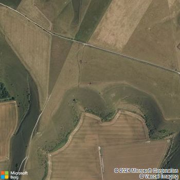
Clickable Bing Map
This page last updated: 3rd February, 2022
© Avon Hang Gliding & Paragliding Club, 1997-2024
E-Mail the


