31/03/2011 - Horses At Westbury
Following a recent incident when horses were spooked by low flying pilots at the far southern end of the NW ridge pilots adjacent to the road, pilots are requested to keep at least 300' clearance from the ground in this area.
Read More
19/01/2018 - New Airspace Concessions at Westbury
Changes to Danger Area access at Westbury
Read More
03/06/2020 - Westbury Safety Notes
Notes on safely flying Westbury in different wind directions.
Read More
24/05/2023 - Westbury Advice - Share The Space
We have had some busy days at Westbury of late and a few issues have arisen, which we are keen to avoid in future:
Read More
Site Name
White Horse (Westbury)
Site Type
Avon Site - Currently Available
Grid Reference
ST 900 518
Nearest Postcode
BA13 4SP
Wind Direction
W, WNW, NW, NNW
Site Officer
Timothy Bishop (07943 880505)
Parking
Park in the westernmost car park.
Rigging
This is a public place so do not rig on any of the paths. Do not block the route used to carry hang gliders to take-off. Do not rig hang-gliders on the front of the hill, stay far enough back to give paraglider pilots room to take off and land.
Take Off
Either side of the obelisk on the front of the hill. When conditions permit, paragliders should launch from well to the east of the obelisk. Do not take off from the white horse face of the hill. Be careful to never inflate a paraglider in front of a hang glider to avoid the chance of being blown back. Incidents have occurred.
Local Flying
No deliberate top to bottom flights, so make sure you have a good chance of staying up before you launch. Make sure you know where the Danger Area boundaries are. There may be airspace concessions available on a particular day. To understand what these are read the -
Concession Guide. There is a riding stable just beyond the trees at the western end of the main ridge and we have been asked to stay at least 600’ ato when overflying this area (See map). The bowl area is often shared with model flyers, please allow them space to fly.
XC Flying
If you intend to fly XC make sure you have a map and know the position of the danger area. Airspace concessions may be available on a particular day. To understand what these are read the -
Concession Guide. Note that if tracking east, the danger area extends further north in that direction.
Top Landing
Do not land on the side of the hill, especially on the White Horse as it is a national monument. Land anywhere on the common area behind the parked cars. Beware of members of the public,
especially those flying kites. This area can be very turbulent in fresh winds, especially if the winds are northerly. In these conditions, land back in the rough grass. It is also possible to land in front of the posts on both paragliders and hang gliders.
Whenever possible use this area only mid-week when the site is not crowded with members of the public. It is also possible for experienced paraglider pilots to land on the spur to the north of the horse’s nose. Watch out for rabbit holes and carry back to take off via the public footpath which comes up from the road.
Do not land on the flat area behind the White Horse. (Turbulence)
Do not land in any of the farmer's fields on the top or side of the hill.
Bottom Landing
No deliberate top to bottom flights allowed. Be wary of livestock, especially when there are calves around. Try to land away from livestock. The field available for emergency landings is the large grass field south of the road with the short driveway and gate in the northwestern corner.
If you do bottom land, clear the area asap as there may be other pilots needing to land. De-rig by the gate or at the edge of the field. If you accidentally land in another field, find your way out via the gates, never climb over fences.
Do not walk back up the face of the hill. Go out of the gate, then along the road to the east and walk up the footpath on the spur.
You can park in the short driveway before the gate to retrieve your glider but never drive into the field.
Directions
Just after leaving Westbury on the B3098 to Bratton turn right up Newton Road. At the crossroads at the top of the hill, turn left and drive until the road reaches the large grass common area.
Ordnance Survey Sheet
184

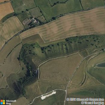
Clickable Bing Map
This page last updated: 3rd February, 2022
© Avon Hang Gliding & Paragliding Club, 1997-2024
E-Mail the


